Selkirk Planning & Design

Selected Work

Projects

Service
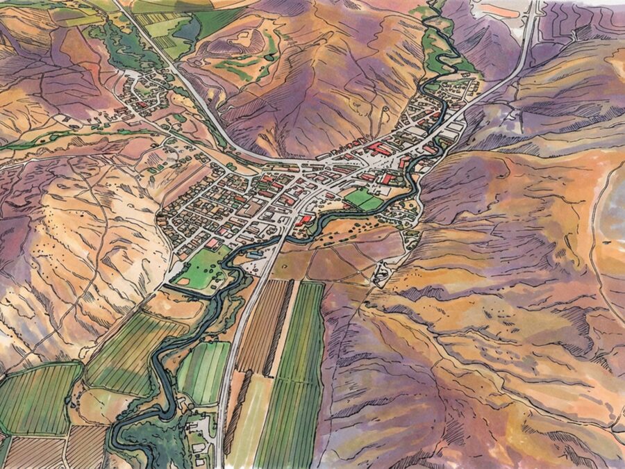
Watercolour-style aerial illustration of Cache Creek where the highways meet, surrounded by farmland and dry hills

Cache Creek, BC  ·  2026

CACHE CREEK OFFICIAL COMMUNITY PLAN UPDATE

Village of Cache Creek
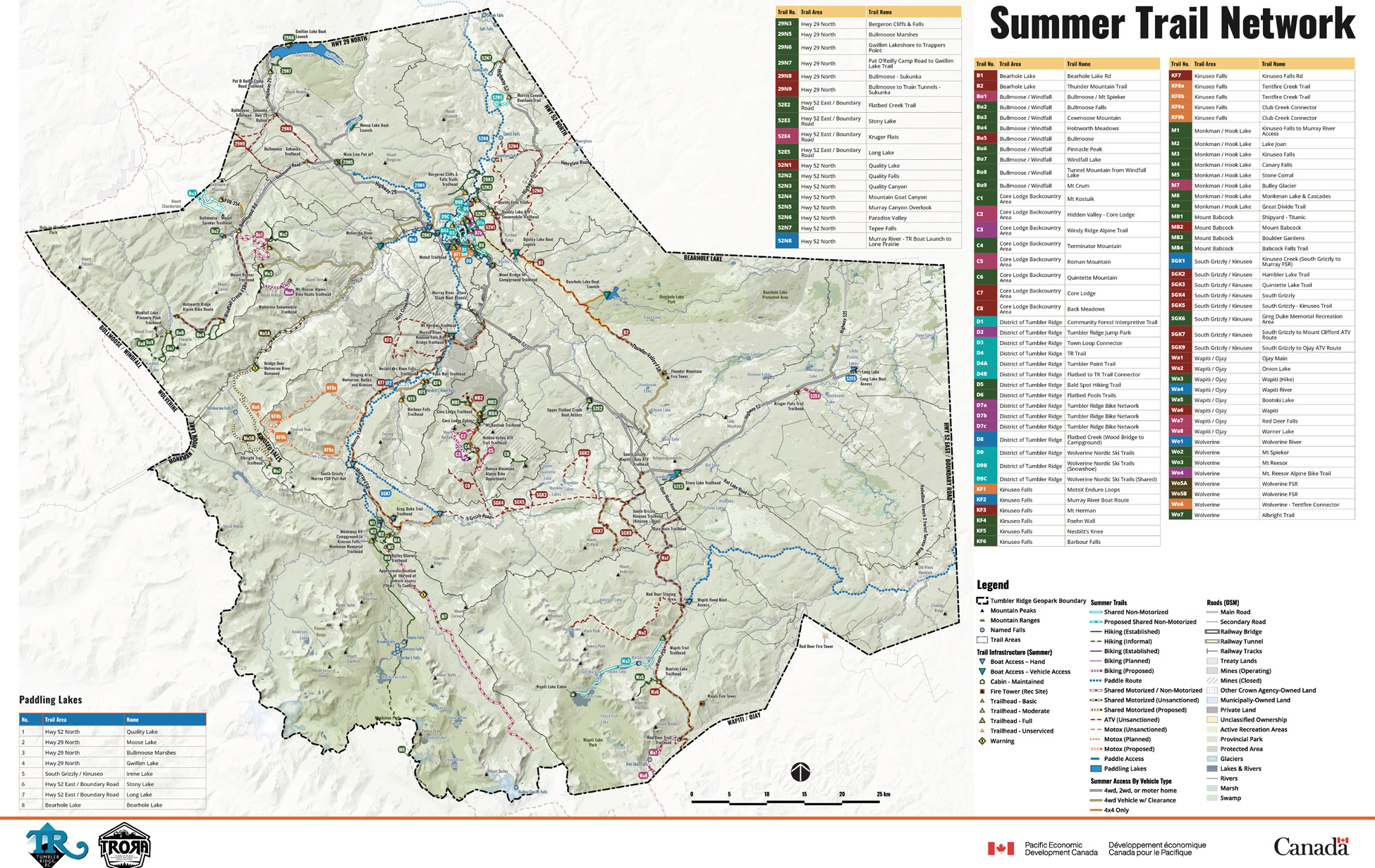
Summer trail network map for the Tumbler Ridge UNESCO Global Geopark, paired with a full index of trail names by area

Tumbler Ridge, BC  ·  2026

TUMBLER RIDGE TRAILS & OUTDOOR RECREATION STRATEGY

District of Tumbler Ridge & TRORA
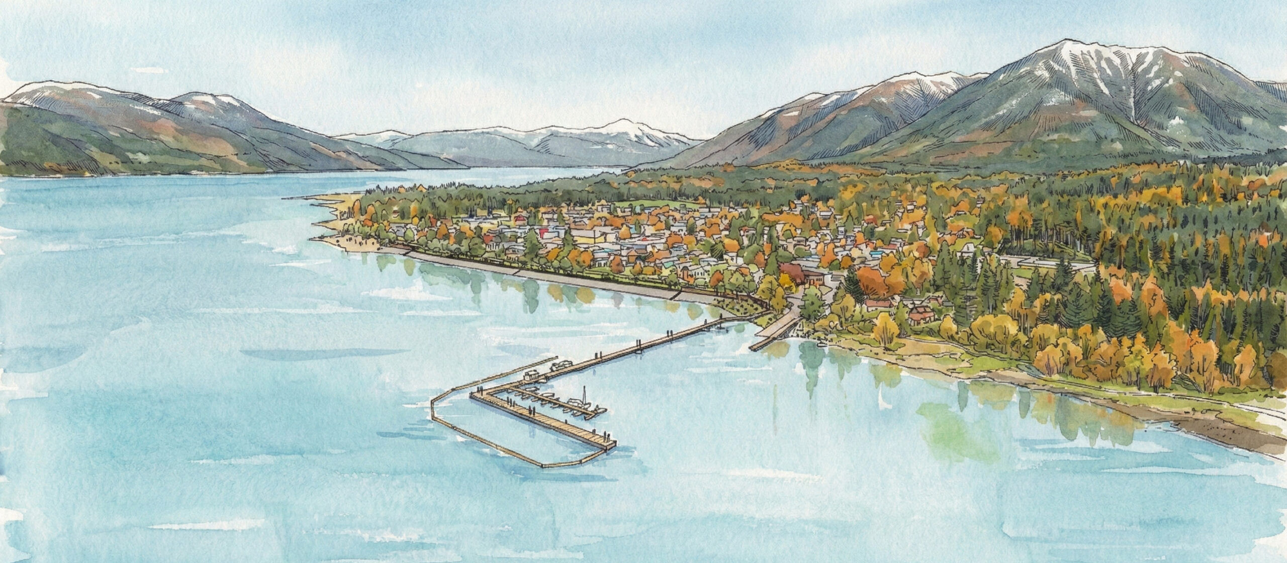
Watercolour aerial of Nakusp from over Upper Arrow Lake in autumn, with the waterfront, the marina, and the town against forested hills

Nakusp, BC  ·  2026

NAKUSP WATERFRONT MASTER PLAN

Village of Nakusp
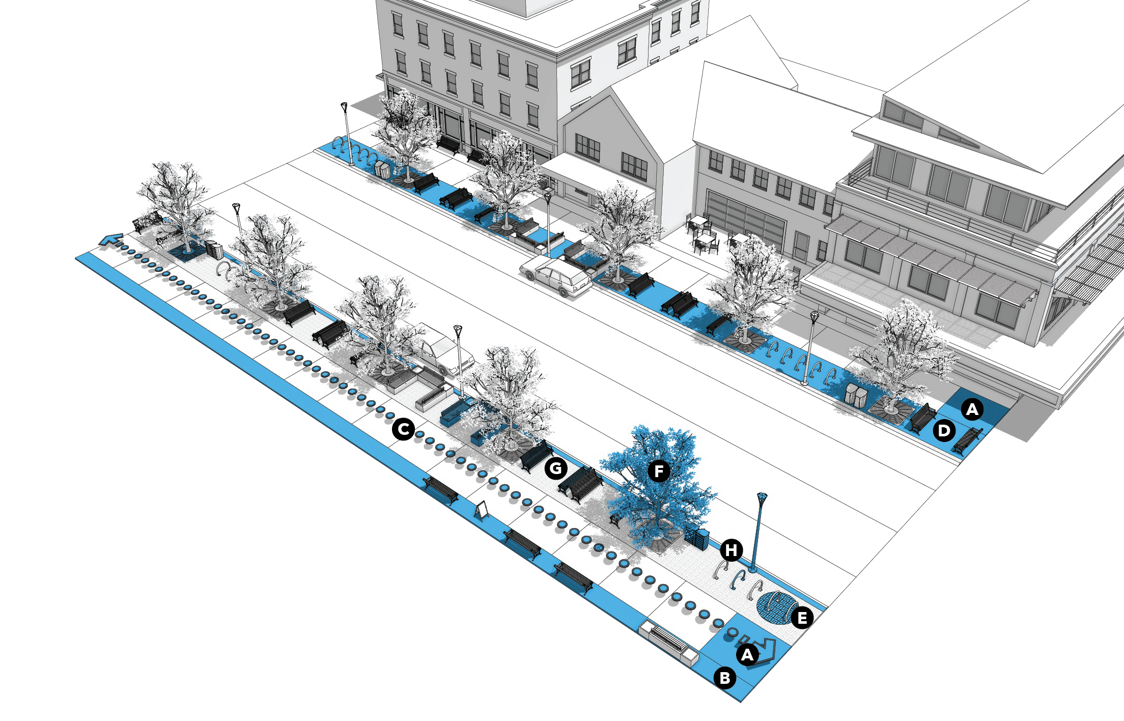
Axonometric of a downtown Okotoks street frontage, keyed to the public realm opportunities set out in the plan, with patios, street trees, and parking picked out in blue

Okotoks, AB  ·  2025

OKOTOKS DOWNTOWN AREA REDEVELOPMENT PLAN

Town of Okotoks
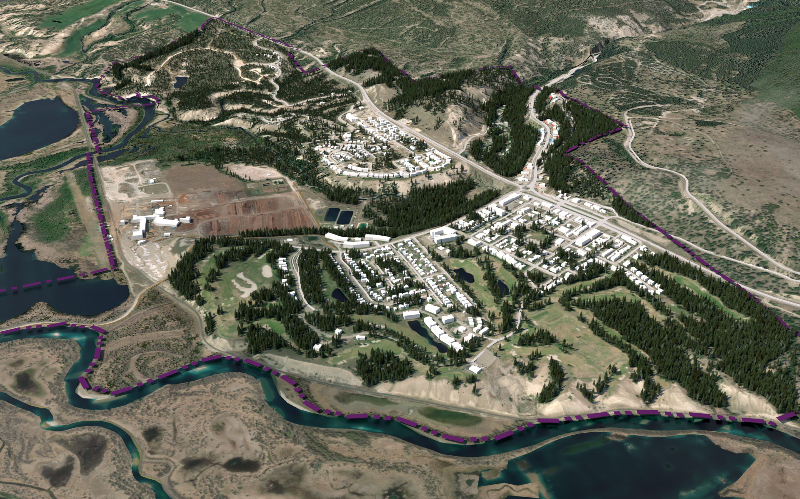
Aerial photograph of Radium Hot Springs, showing the village, the airstrip, and the golf course set between the wetlands of the Columbia River and the forested benchlands

Radium Hot Springs, BC  ·  2024-Present

RADIUM OFFICIAL COMMUNITY PLAN & ZONING BYLAW

Village of Radium Hot Springs
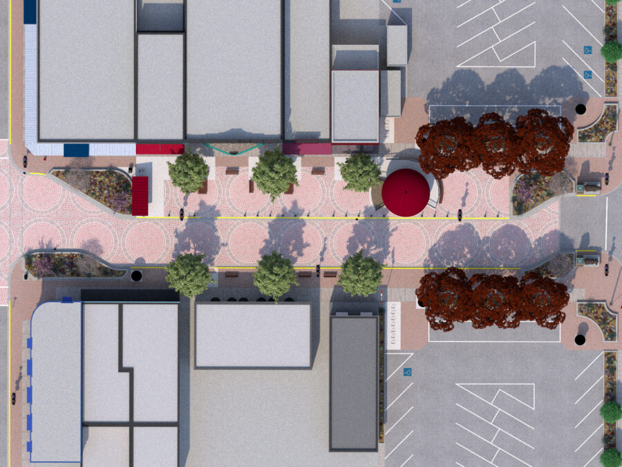
Overhead plan of the final Grizzly Plaza design, showing the patterned paving, the bandshell, planters, benches, street trees, and the parking and shopfronts either side

Revelstoke, BC  ·  2024

GRIZZLY PLAZA DESIGN CONCEPT

City of Revelstoke
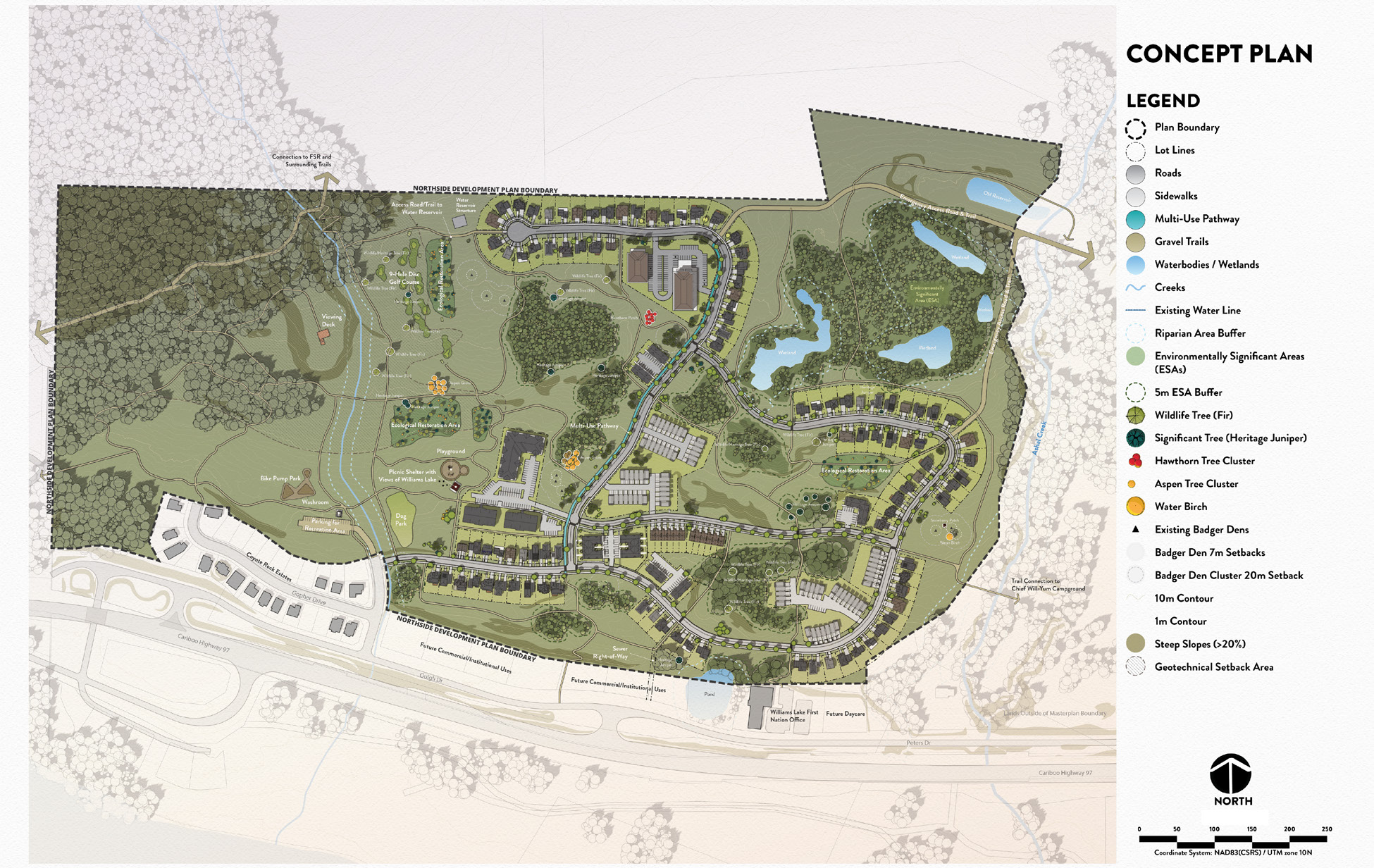
Concept plan for the Williams Lake First Nation Northside lands, keyed to roads, trails, wetlands, environmentally significant areas, badger dens, steep slopes, and geotechnical setbacks

Williams Lake, BC  ·  2024

WILLIAMS LAKE FIRST NATION NORTHSIDE MASTER PLAN

Williams Lake First Nation
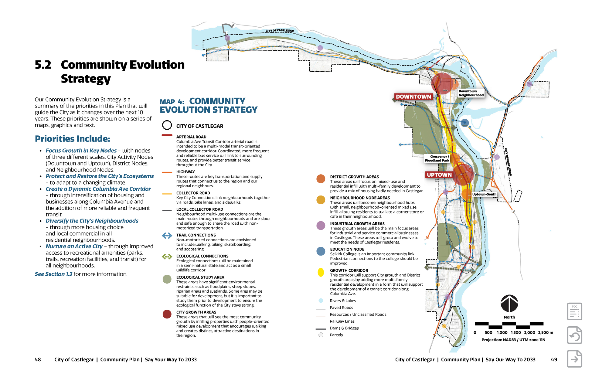
Community Evolution Strategy spread from the Castlegar Community Plan, with the priorities set out beside a map of growth areas, nodes, and corridors along the Columbia River

Castlegar, BC  ·  2024

CASTLEGAR COMMUNITY PLAN & ZONING BYLAW UPDATE

City of Castlegar
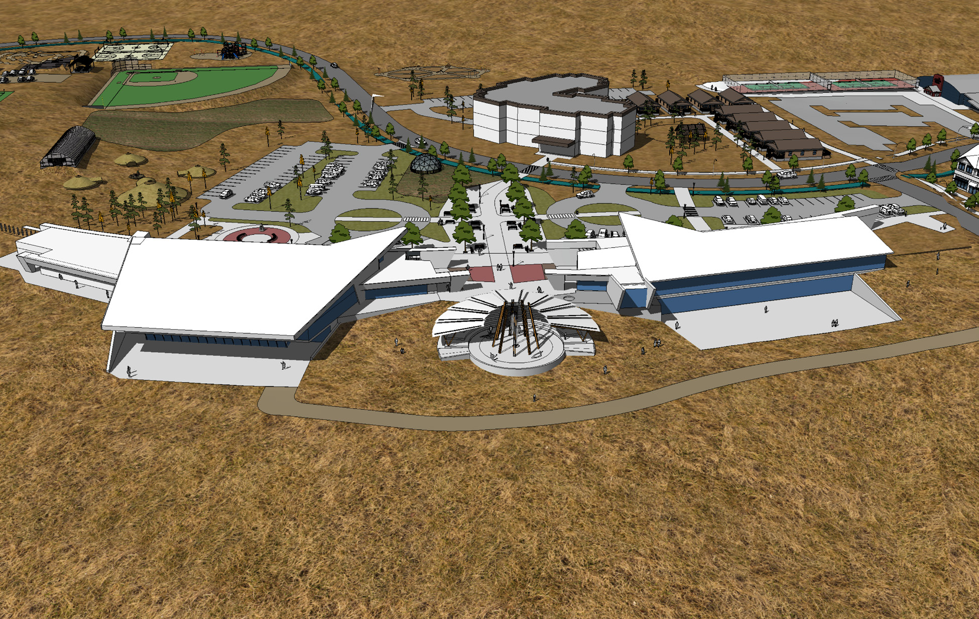
Aerial rendering of the SnPink'tn Community Core, showing the administration and multi-purpose buildings around the community fire circle, with the ball diamond and parking beyond

Penticton Indian Band, BC  ·  2023

SnPink’tn (PENTICTON INDIAN BAND) COMMUNITY CORE MASTER PLAN

Penticton Indian Band
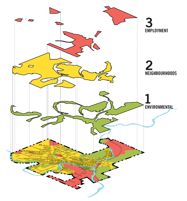
Exploded three-layer diagram of the Grand Forks land use plan, separating environmental areas, neighbourhoods, and employment lands above the combined map

Grand Forks, BC  ·  2022

GRAND FORKS OFFICIAL COMMUNITY PLAN

City of Grand Forks
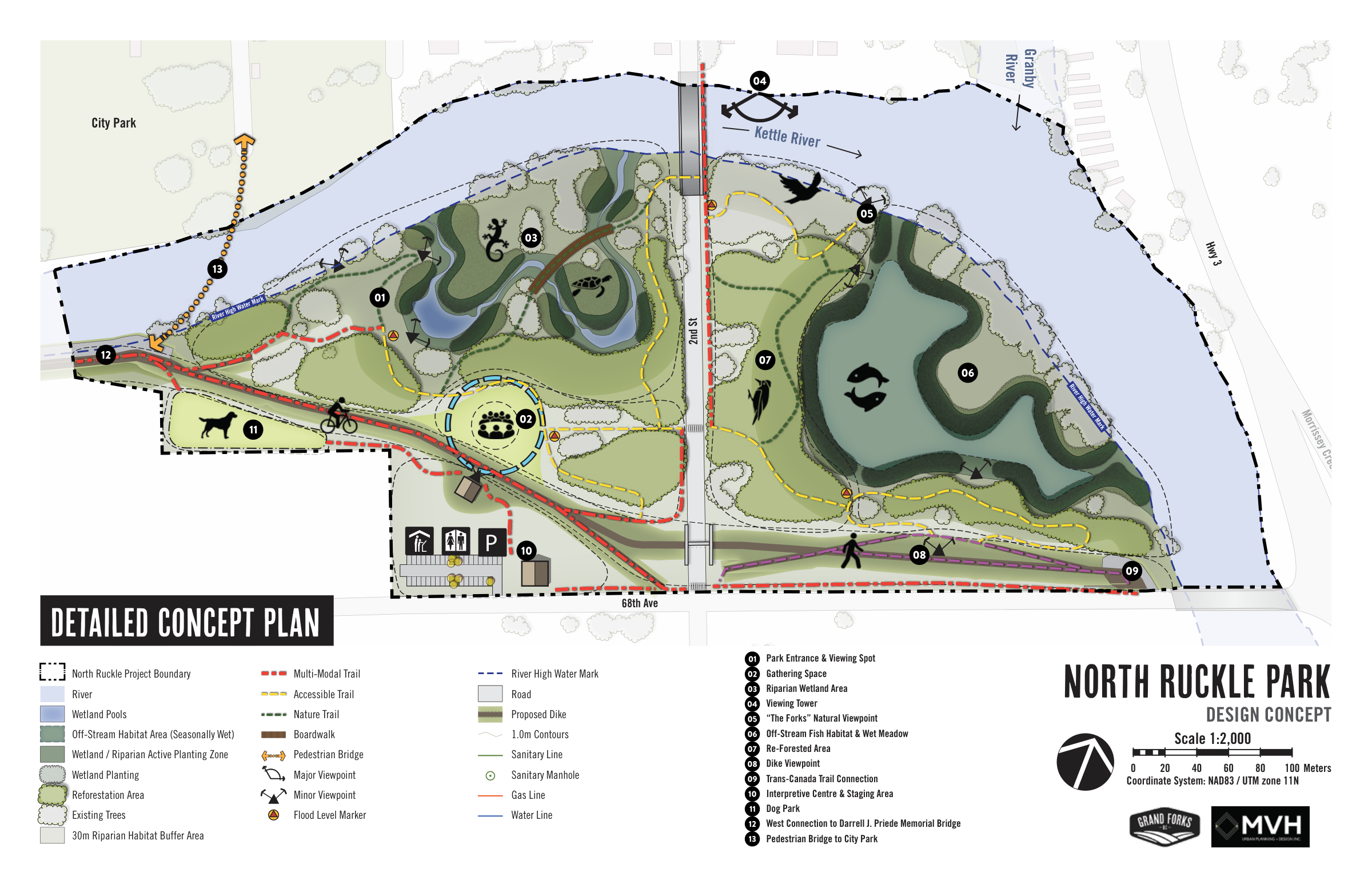
Detailed concept plan for North Ruckle Park, showing wetland pools, off-stream fish habitat, riparian planting, trails, and viewpoints along the Kettle River

Grand Forks, BC  ·  2022

NORTH RUCKLE FLOODWAY PARK DESIGN CONCEPT

City of Grand Forks
Cover of the Village of Slocan Official Community Plan, Bylaw No. 700, with an illustrated panorama of the waterfront, beach, and village

Slocan, BC  ·  2022

SLOCAN OFFICIAL COMMUNITY PLAN

Village of Slocan
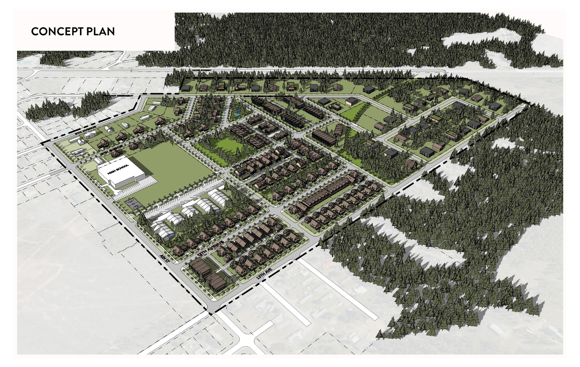
Aerial concept plan for Valemount, showing the proposed blocks, live and work units, community park, and industrial lots against the forest edge

Valemount, BC  ·  2021

VALEMOUNT OFFICIAL COMMUNITY PLAN & ZONING BYLAW

Village of Valemount
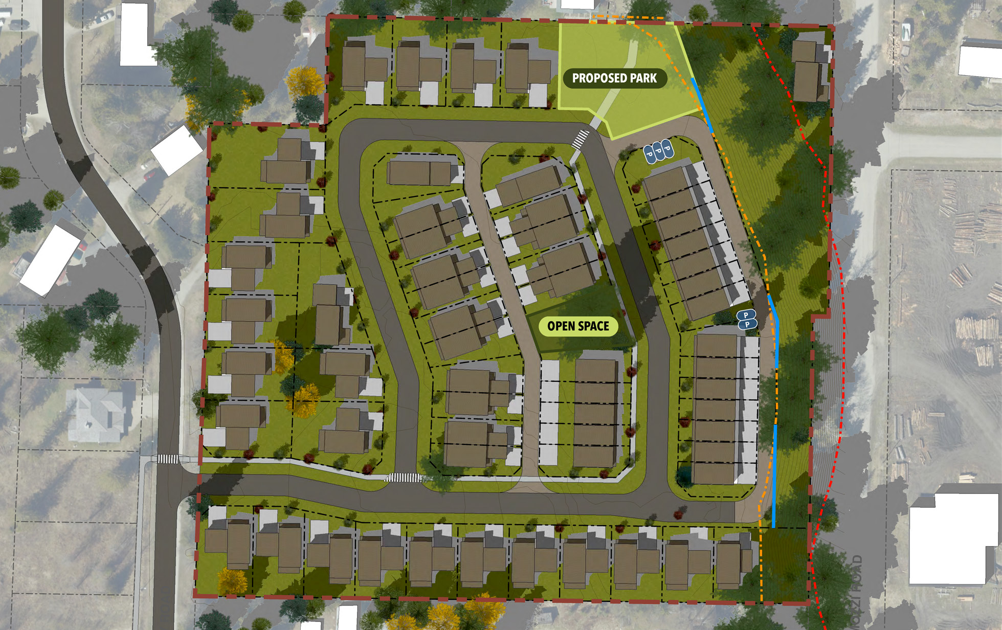
Master plan aerial of the Stoked Living passive house neighbourhood, showing the lot layout, internal road loop, proposed park, and retained open space

Revelstoke, BC  ·  2021

STOKED LIVING PASSIVE COMMUNITY MASTER PLAN

Private Client
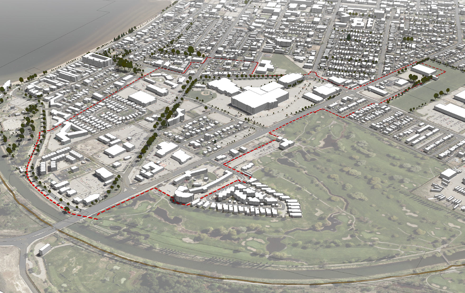
Three-dimensional aerial model of the study area in Penticton, with the plan boundary outlined over the street grid, the lakeshore, and the creek corridor

Penticton, BC  ·  2021

PENTICTON 3D PLAN

City of Penticton

Aerial concept for Centennial Park in New Denver, showing the lakeshore, beach, campground loop, playing field, and trails

New Denver, BC  ·  2021

NEW DENVER CENTENNIAL PARK MASTER PLAN CONCEPT

Village of New Denver
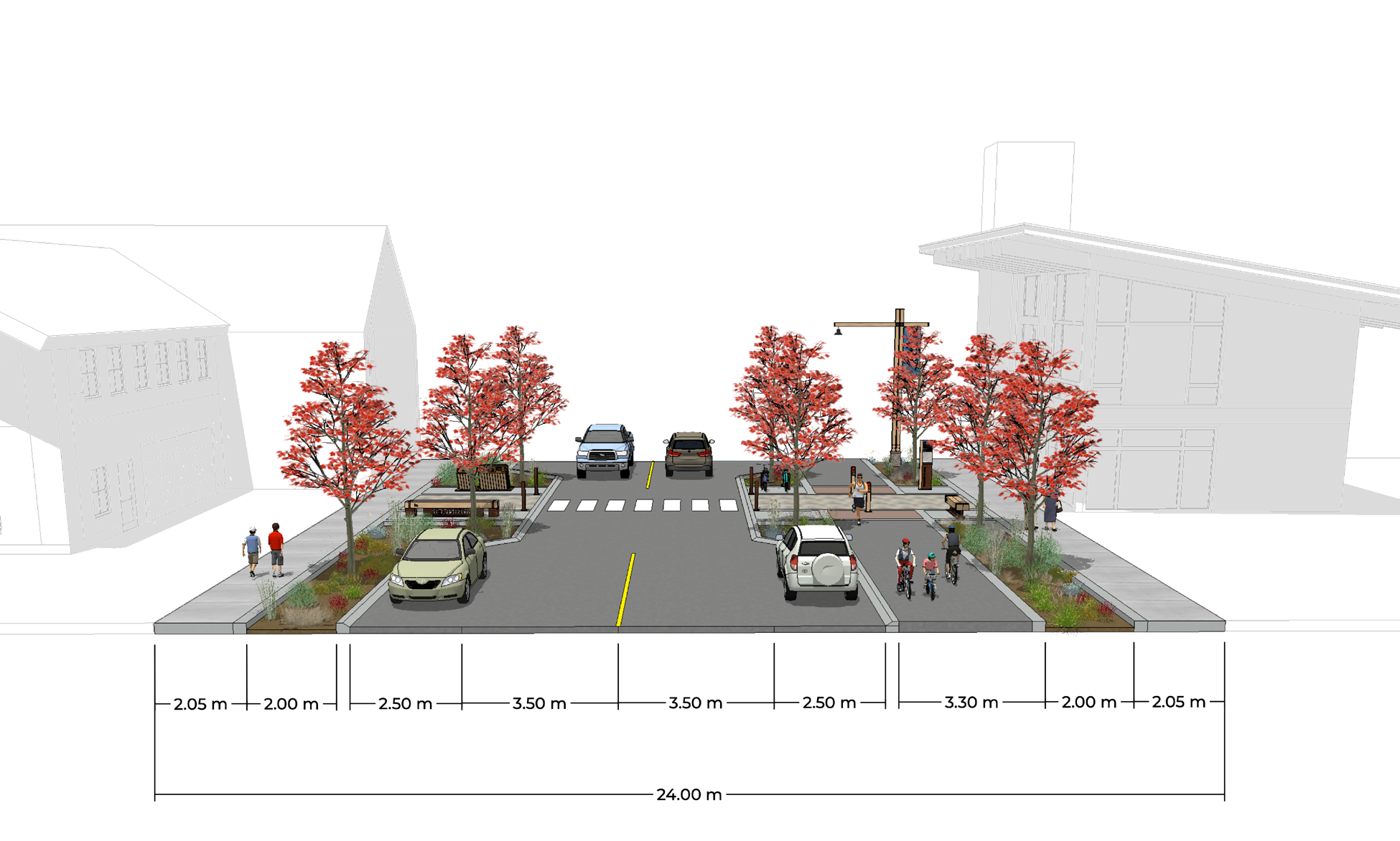
Rendered cross-section of the rebuilt downtown street, dimensioning the sidewalks, planted boulevards, parking, and travel lanes across a 24 metre right-of-way

Canal Flats, BC  ·  2021

CANAL FLATS DOWNTOWN STREETSCAPE PLAN

Village of Canal Flats
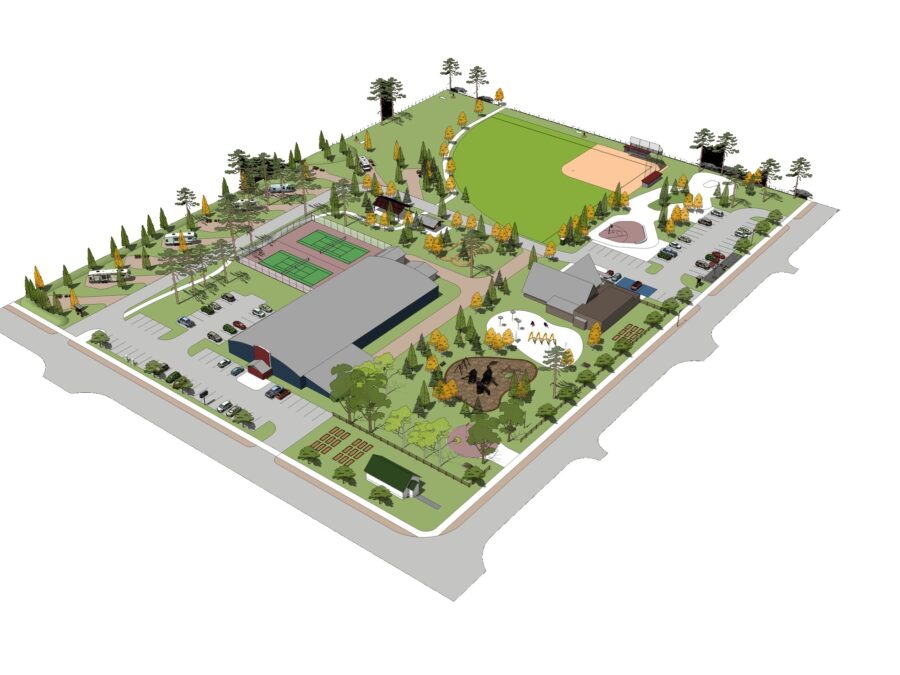
Aerial concept plan for Lion's Park in Canal Flats, showing the ball field, courts, arena and campground

Canal Flats, BC  ·  2020

CANAL FLATS LION’S PARK CONCEPT PLAN

Village of Canal Flats
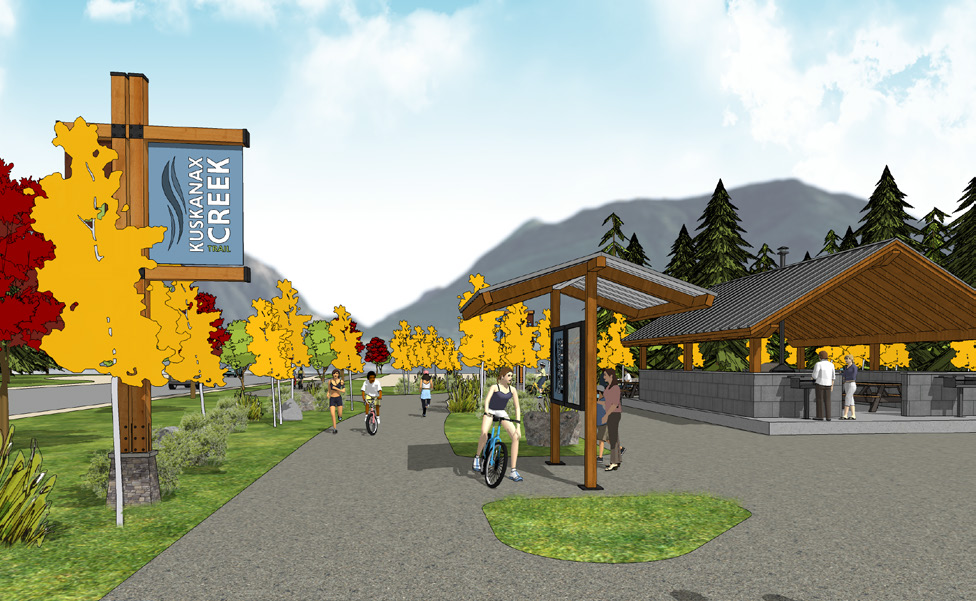
Rendering of the Kuskanax Creek trail entrance with a timber sign, a picnic shelter, and people walking and cycling

Nakusp, BC  ·  2020

VILLAGE OF NAKUSP OFFICIAL COMMUNITY PLAN

Village of Nakusp
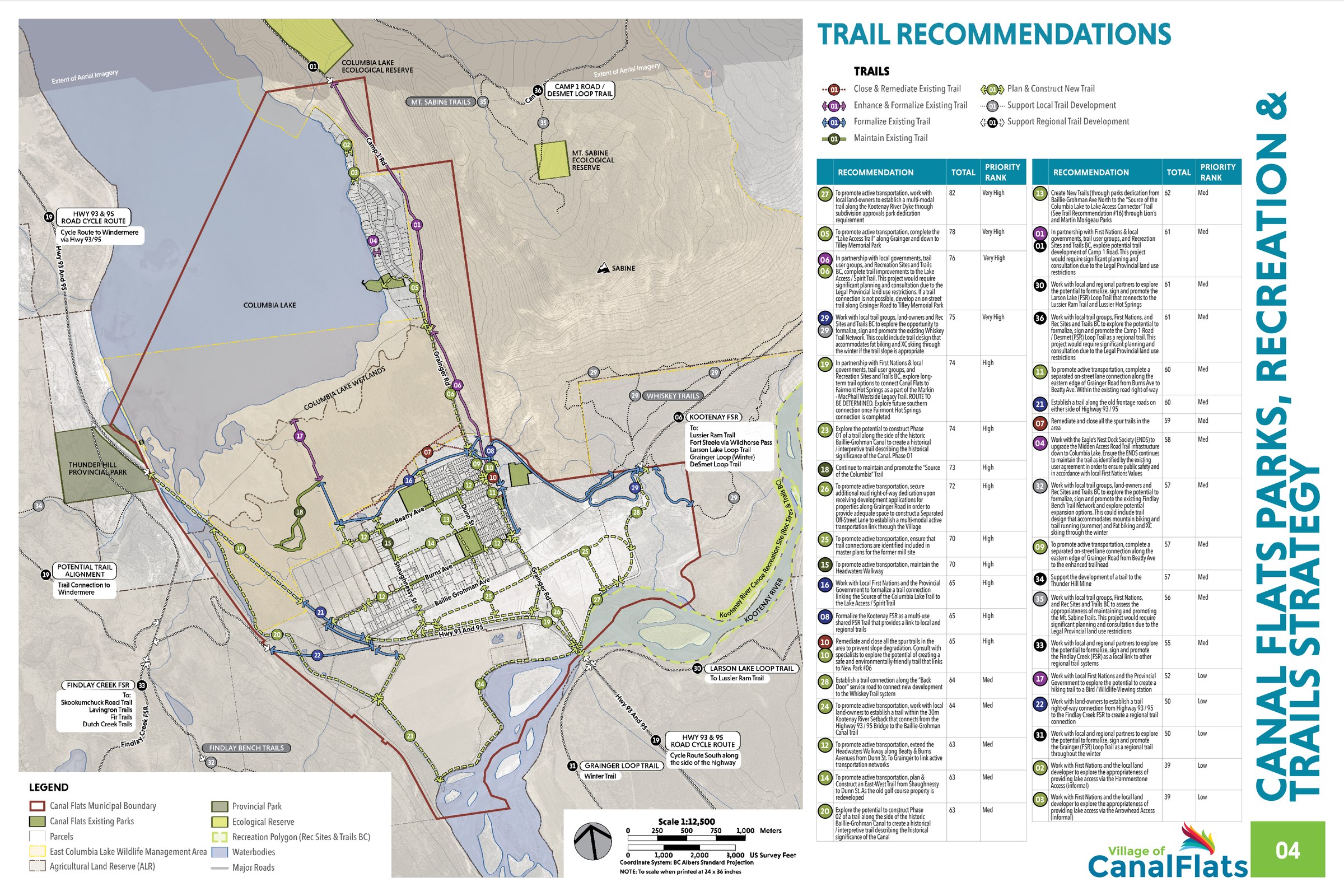
Trail recommendations map for Canal Flats, pairing the trail network over the valley with a ranked table of recommendations and their priorities

Canal Flats, BC  ·  2020

CANAL FLATS PARKS, RECREATION & TRAILS STRATEGY

Village of Canal Flats
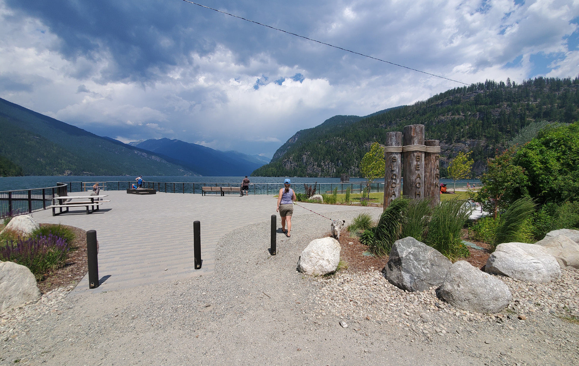
Photograph of the completed Slocan waterfront, with the paved plaza, carved timber gateway posts, benches, and Slocan Lake beyond

Slocan, BC  ·  2019

SLOCAN WATERFRONT CONCEPTUAL DESIGN PLAN

Village of Slocan
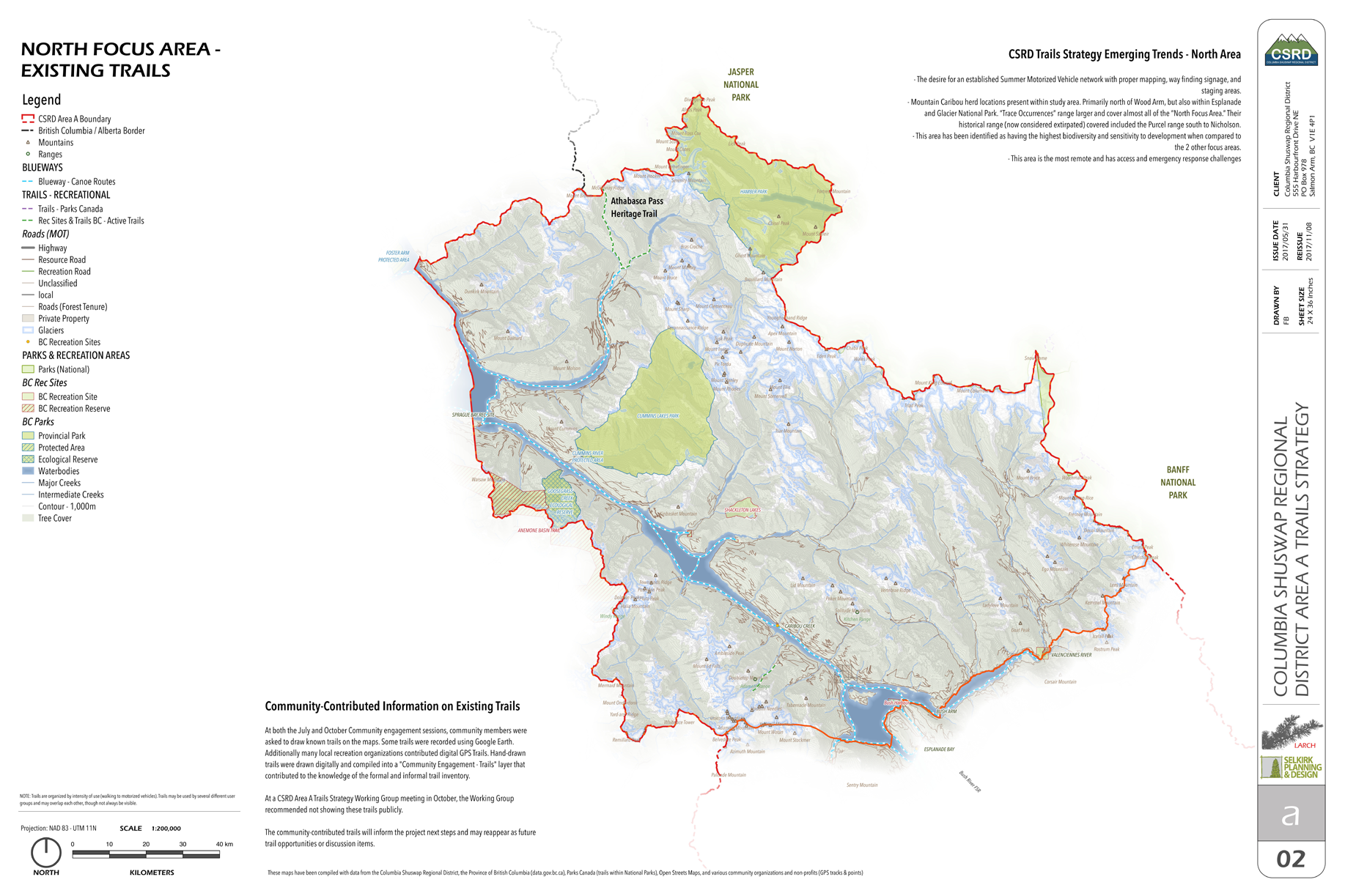
North focus area map of existing trails for the Columbia Shuswap Regional District, covering the mountain country between Jasper and Banff national parks

Golden, BC  ·  2018

GOLDEN + AREA A REGIONAL TRAILS STRATEGY

Columbia Shuswap Regional District
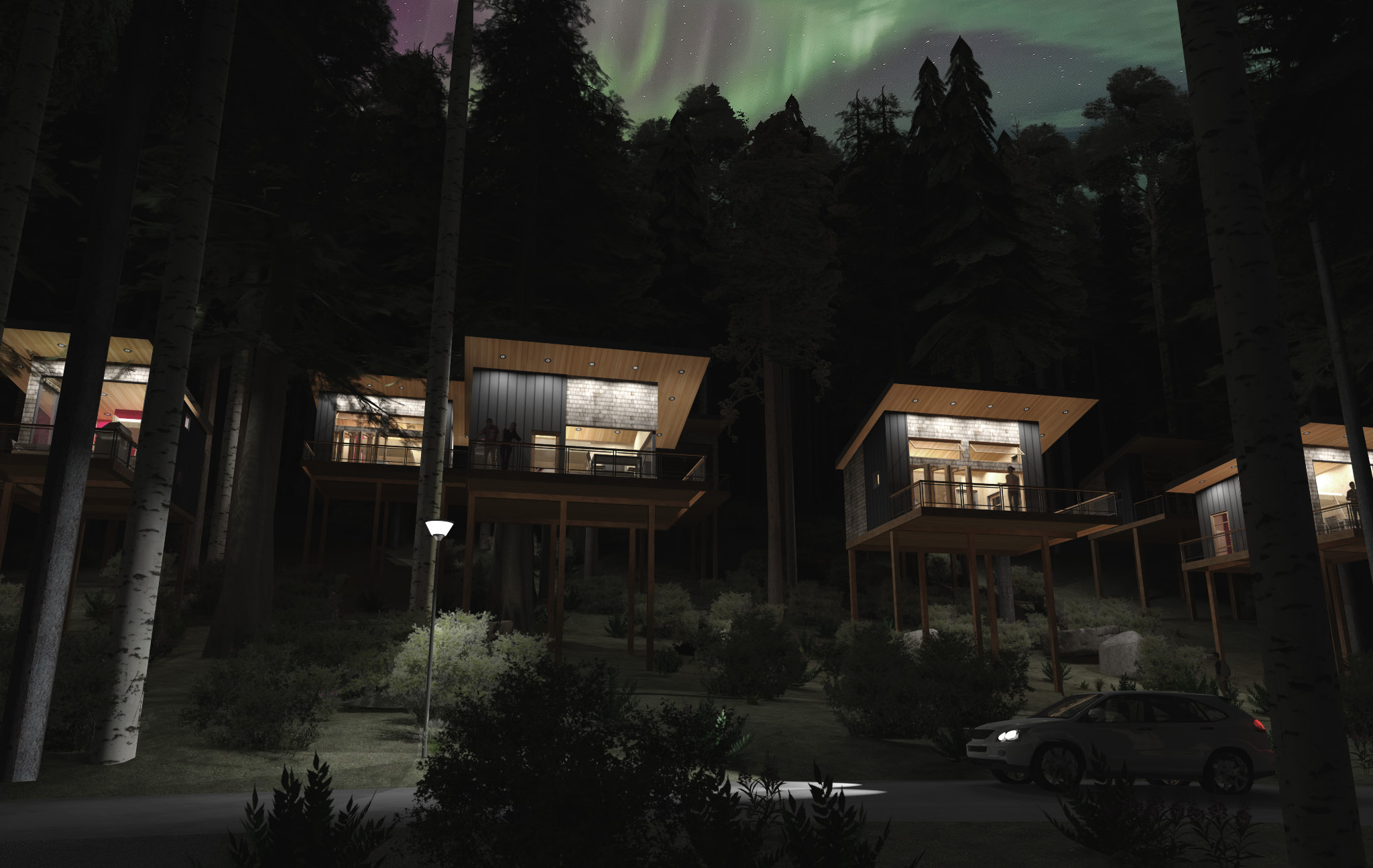
Night rendering of the tree house cabins lit among the cedars, with the northern lights overhead

Revelstoke, BC  ·  2018

REVELSTOKE TREE HOUSE HOTEL MASTER PLAN & REZONING

Private Client
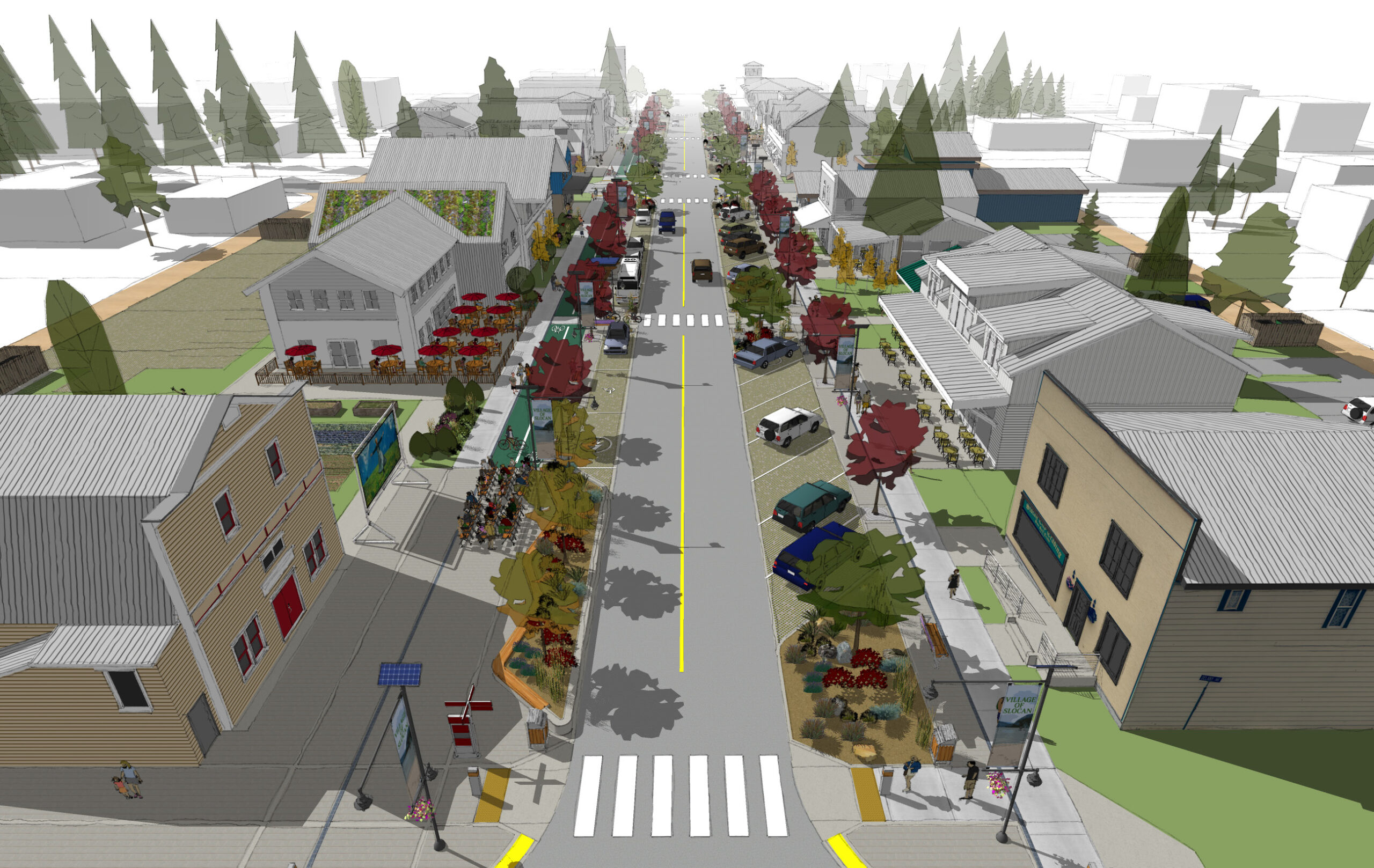
Aerial rendering of Harold Street in Slocan, with angled parking, patios, street trees, and crossings between infill buildings

Slocan, BC  ·  2018

SLOCAN HAROLD STREET NORTH CONCEPTUAL DESIGN PLAN

Village of Slocan
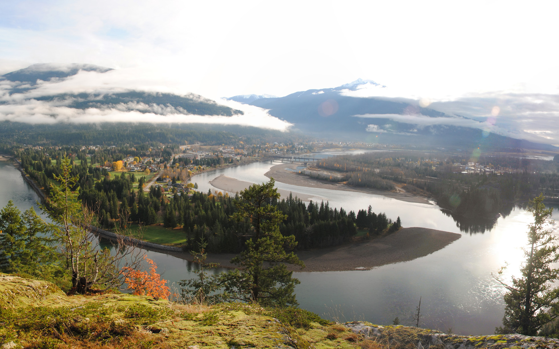
Photograph from a viewpoint above Revelstoke, looking down over the Columbia River as it bends past the town, with cloud lying along the valley

Revelstoke, BC  ·  2017

REVELSTOKE TRAILS STRATEGY

City of Revelstoke
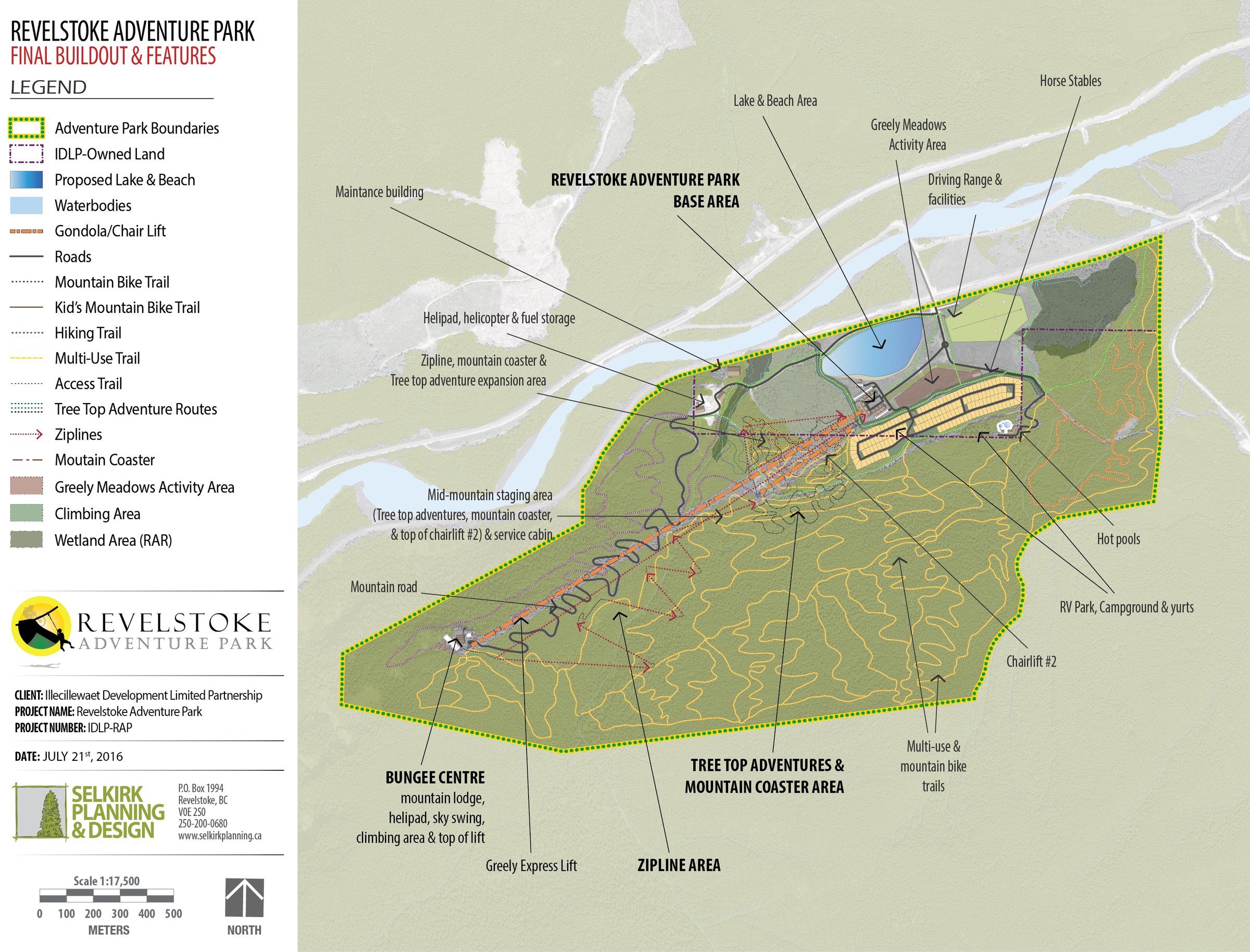
Final buildout plan for the Revelstoke Adventure Park, showing the base area, zipline and tree top adventure areas, mountain coaster, trails, lifts, and wetland areas

Revelstoke, BC  ·  2017

REVELSTOKE ADVENTURE PARK REZONING

Private Client
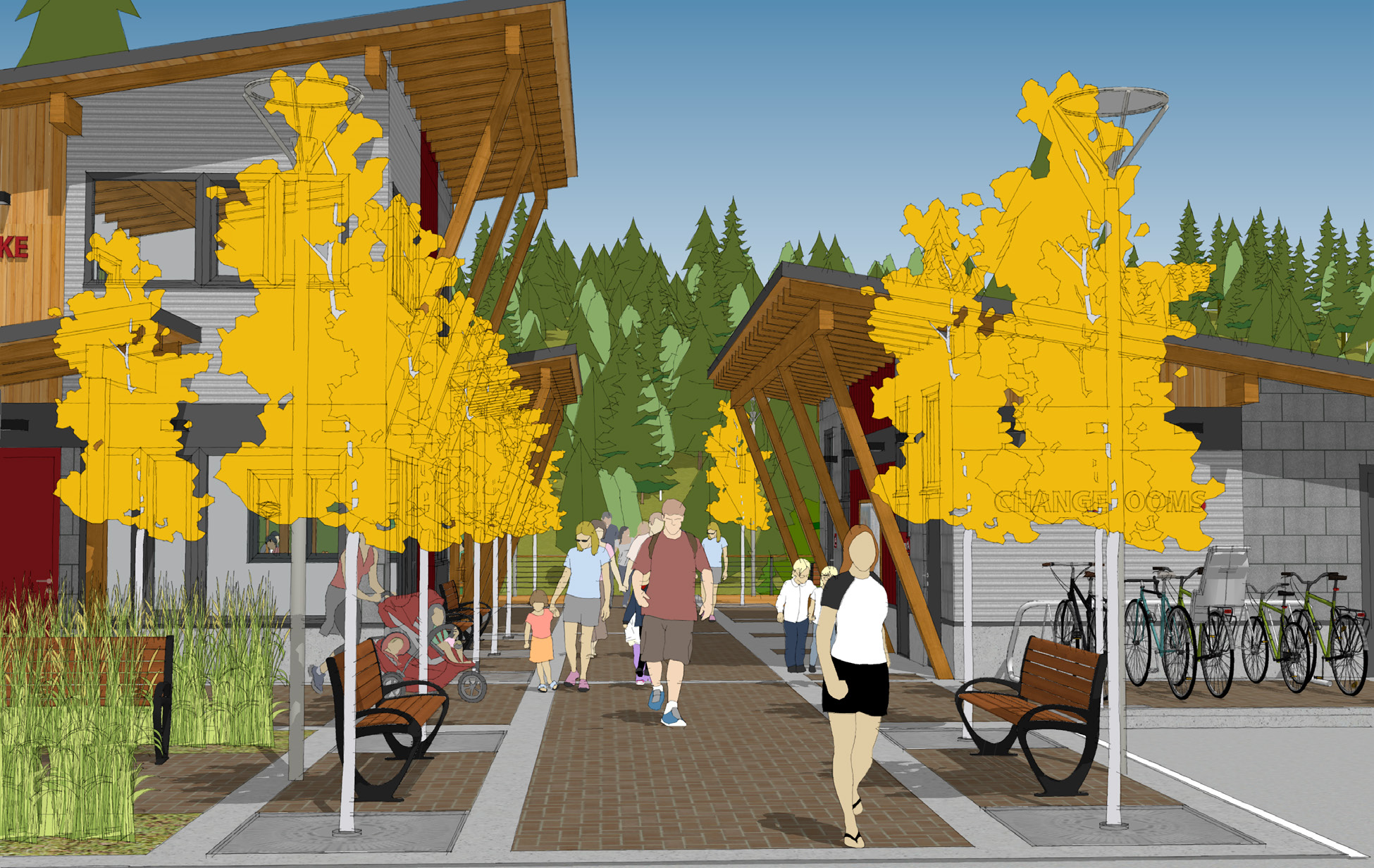
Rendering of the new day use and change room building at Williamson's Lake Park, with autumn trees, benches, bike parking, and families walking the path

Revelstoke, BC  ·  2016

WILLIAMSON’S LAKE PARK & CAMPGROUND CONCEPT PLAN

City of Revelstoke
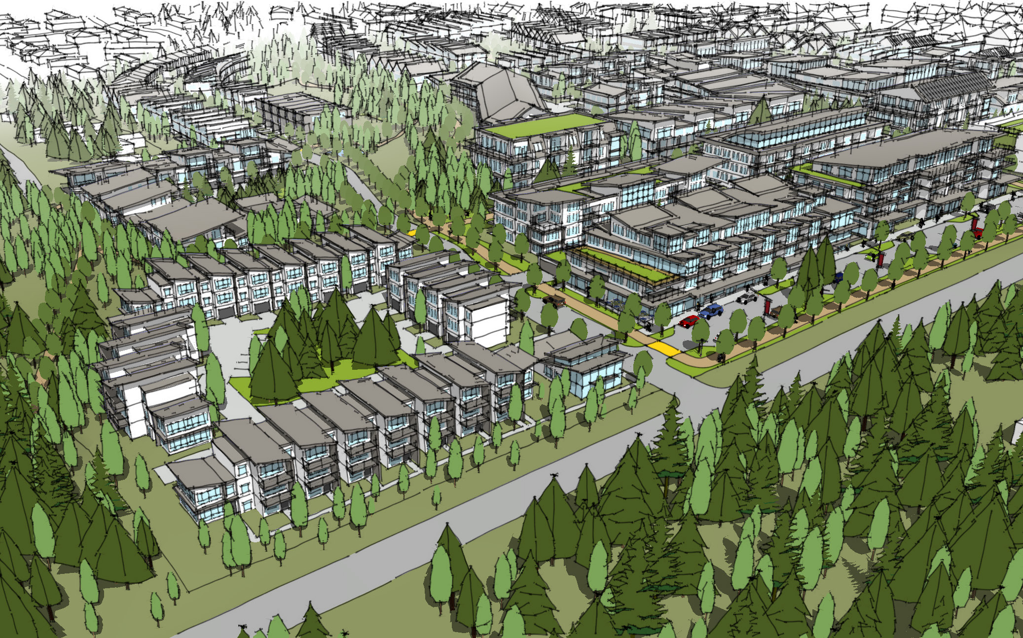
Aerial rendering of Mackenzie Village, showing apartment and townhouse blocks set among retained conifers with the mountains behind

Revelstoke, BC  ·  2016

MACKENZIE VILLAGE MASTER PLAN & REZONING

Private Client
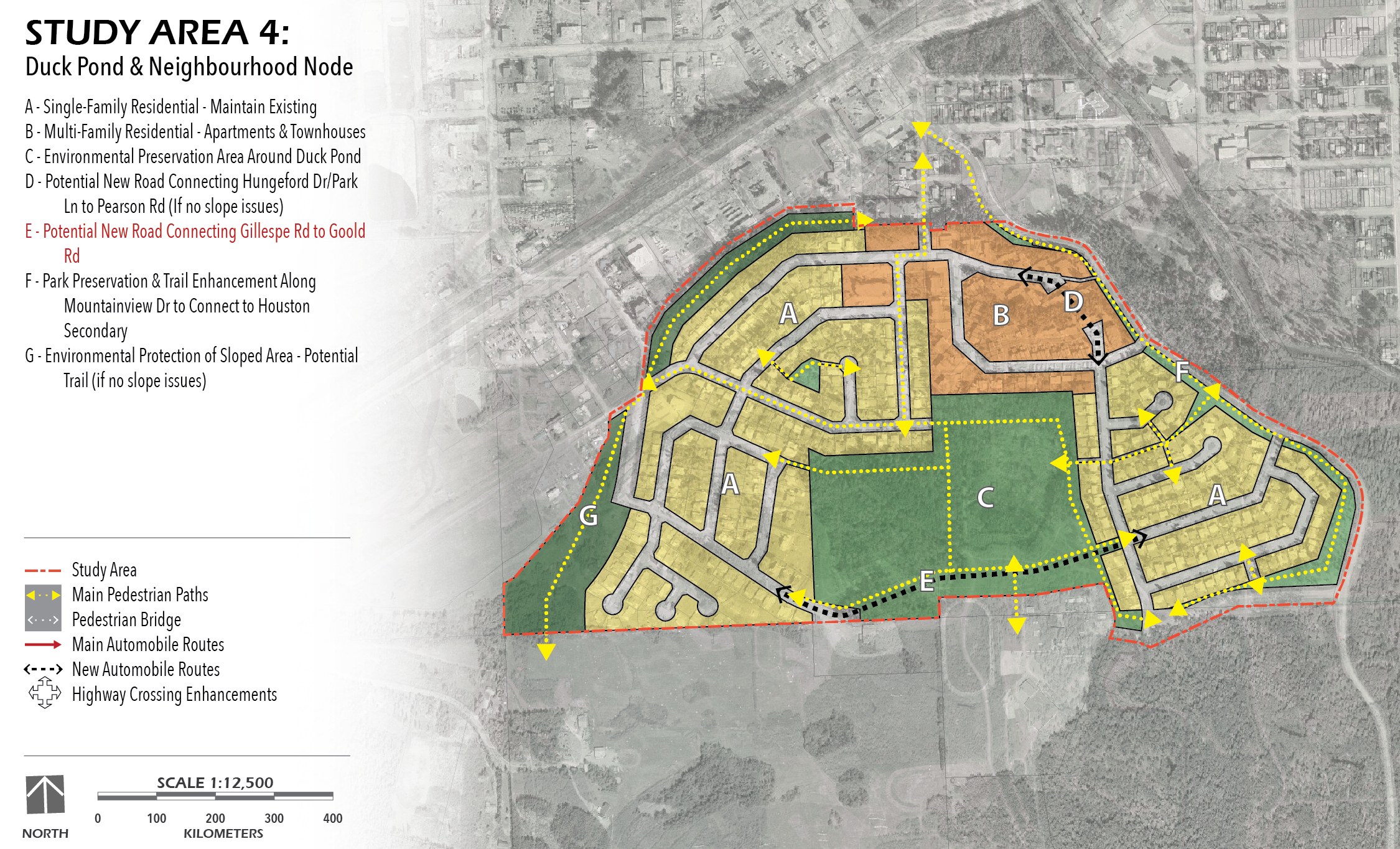
Study area plan for the Duck Pond and neighbourhood node in Houston, lettered A to G with pedestrian paths, new road connections, and environmental protection areas

Houston, BC  ·  2015

HOUSTON LAND USE & ZONING PLAN

District of Houston
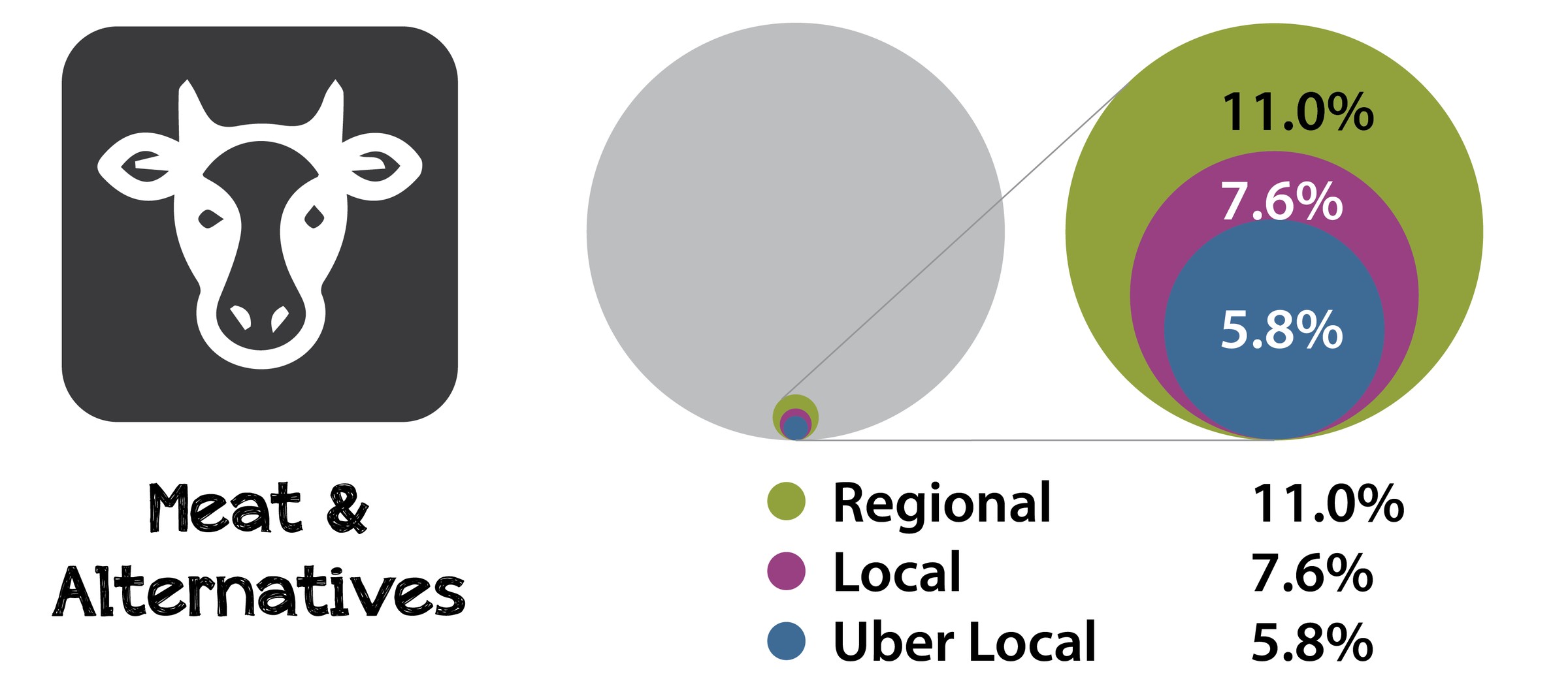
Infographic showing the share of Revelstoke's meat and alternatives met at the regional, local, and uber-local scale

Revelstoke, BC  ·  2014

REVELSTOKE FOOD SECURITY STRATEGY

City of Revelstoke
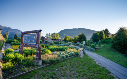
Photograph of the Visual Arts Centre entrance with its timber sign, the xeriscape garden alongside the path, and the mountains behind

Revelstoke, BC  ·  2013

REVELSTOKE VISUAL ARTS CENTRE DESIGN CONCEPT

City of Revelstoke
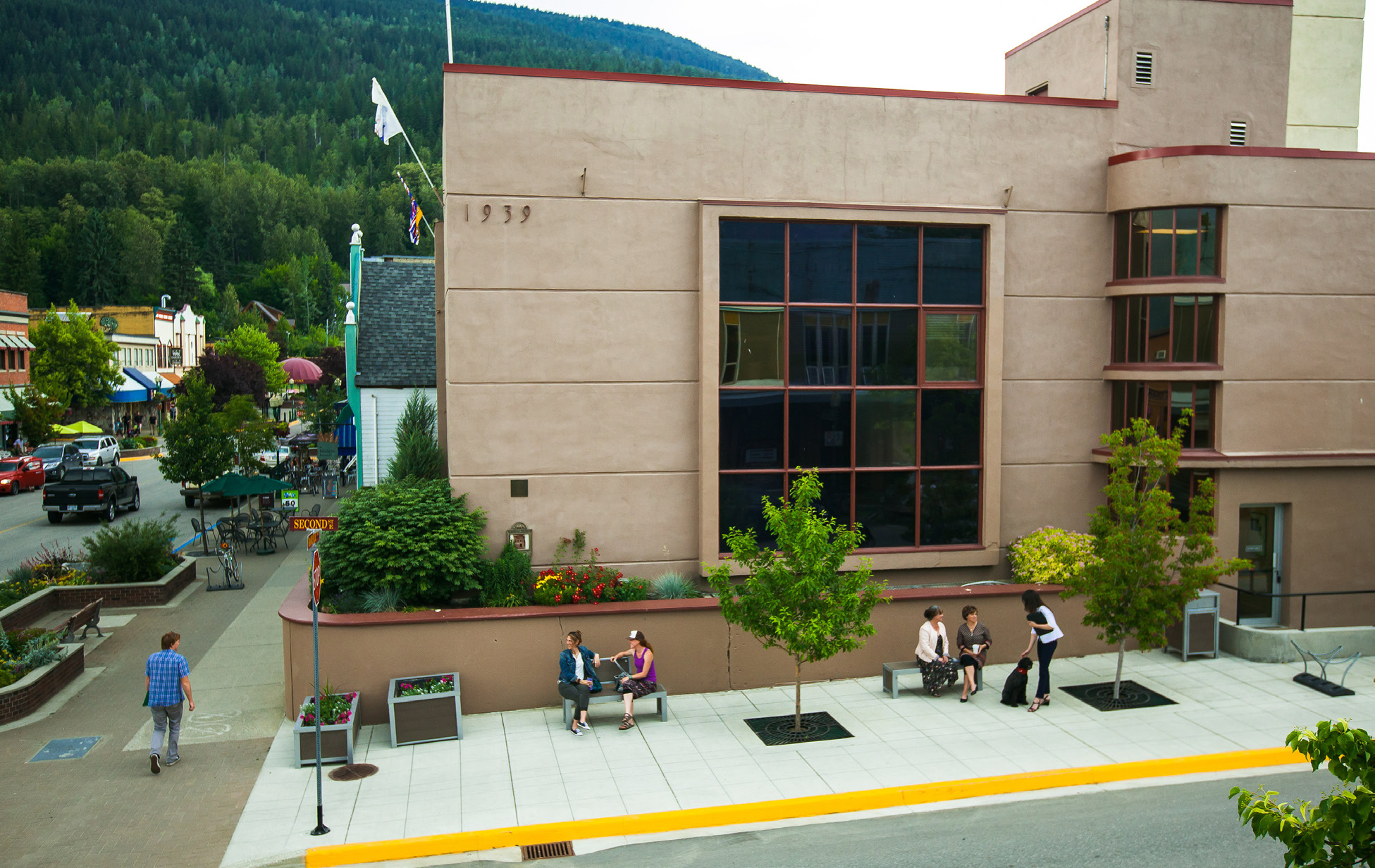
Photograph of the existing Revelstoke City Hall frontage, with people seated on benches along the sidewalk and the downtown street beyond

Revelstoke, BC  ·  2013

REVELSTOKE CITY HALL URBAN DESIGN CONCEPT

City of Revelstoke
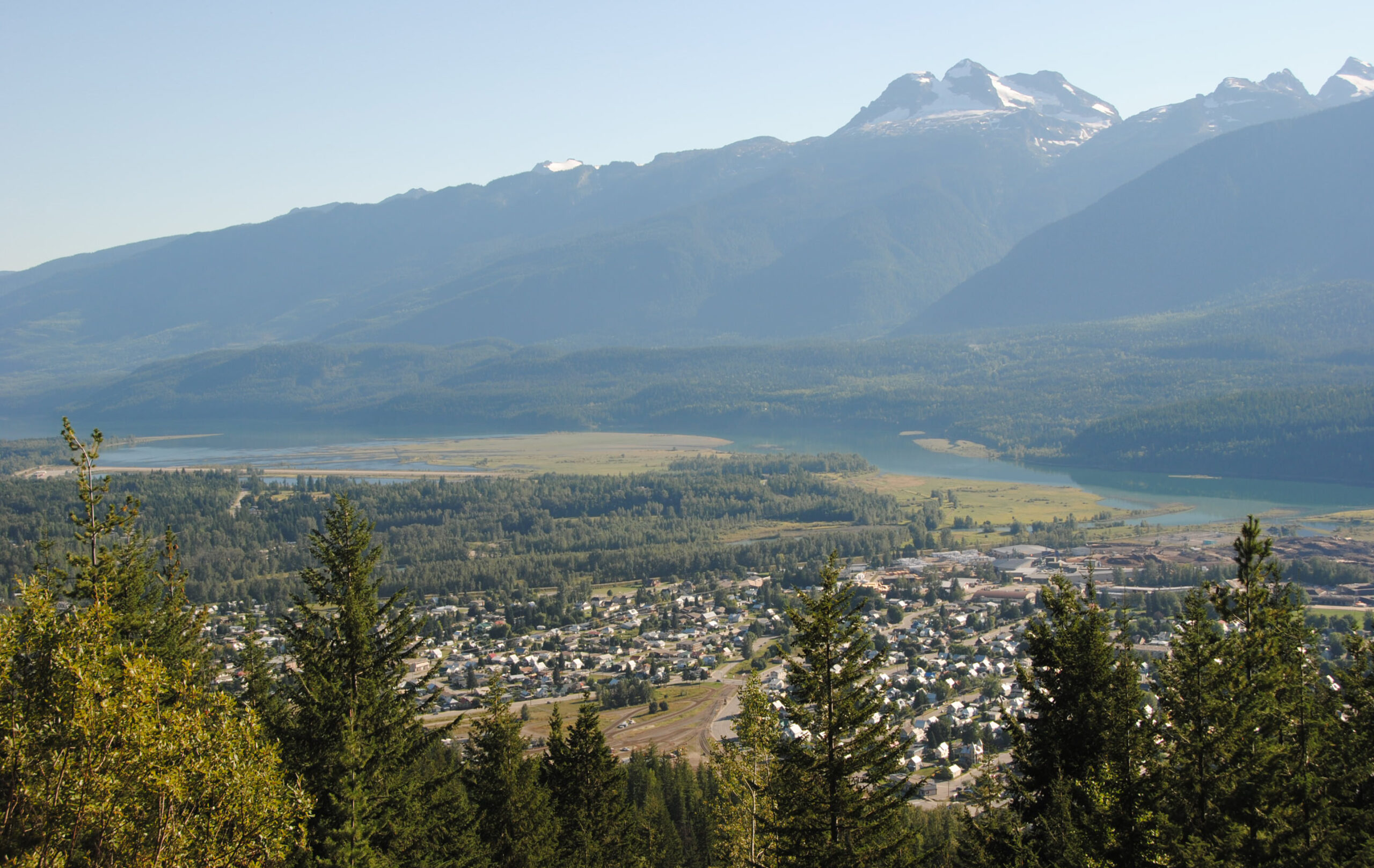
Photograph looking down over Revelstoke from the forested slopes above, with the town on the valley floor and the Monashee peaks beyond

Revelstoke, BC  ·  2013

REVELSTOKE INTEGRATED COMMUNITY SUSTAINABILITY PLAN

City of Revelstoke
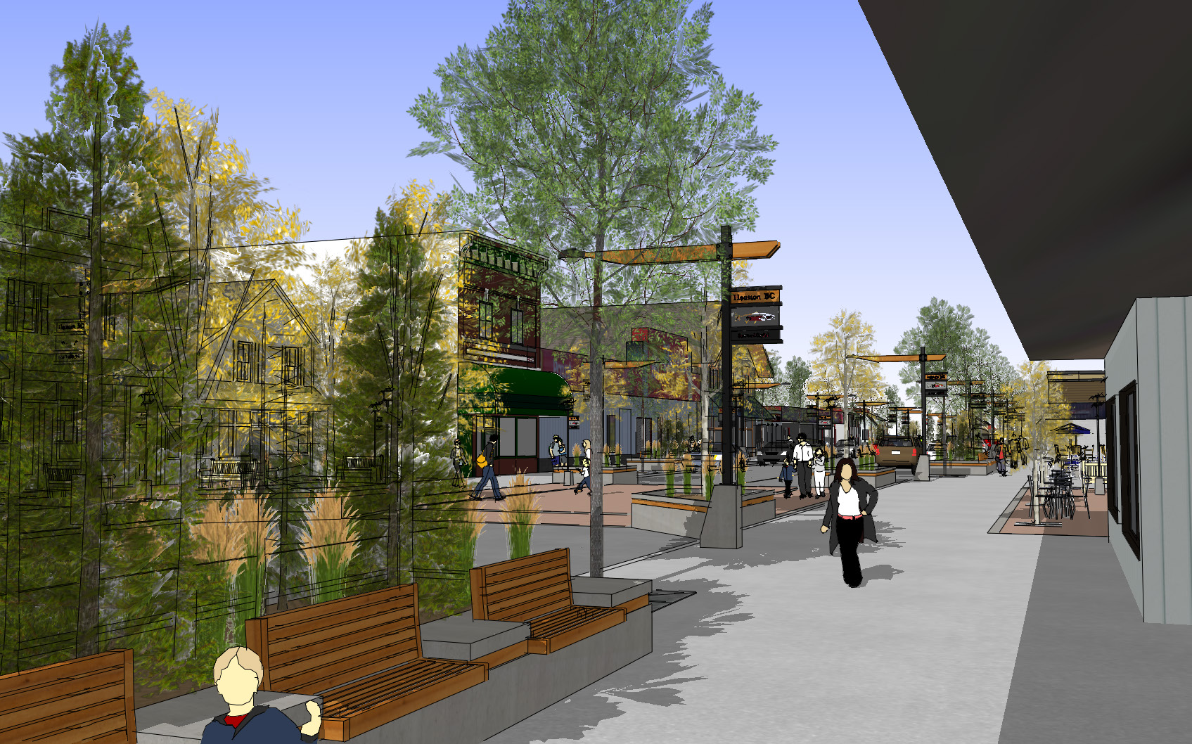
Street-level rendering of the redesigned 9th Street in Houston, with wide sidewalks, street trees, benches, and people walking past storefronts

Houston, BC  ·  2013

HOUSTON 9TH STREET ILLUSTRATIVE PLAN

District of Houston