PENTICTON 3D PLAN
Penticton, BC · 2021
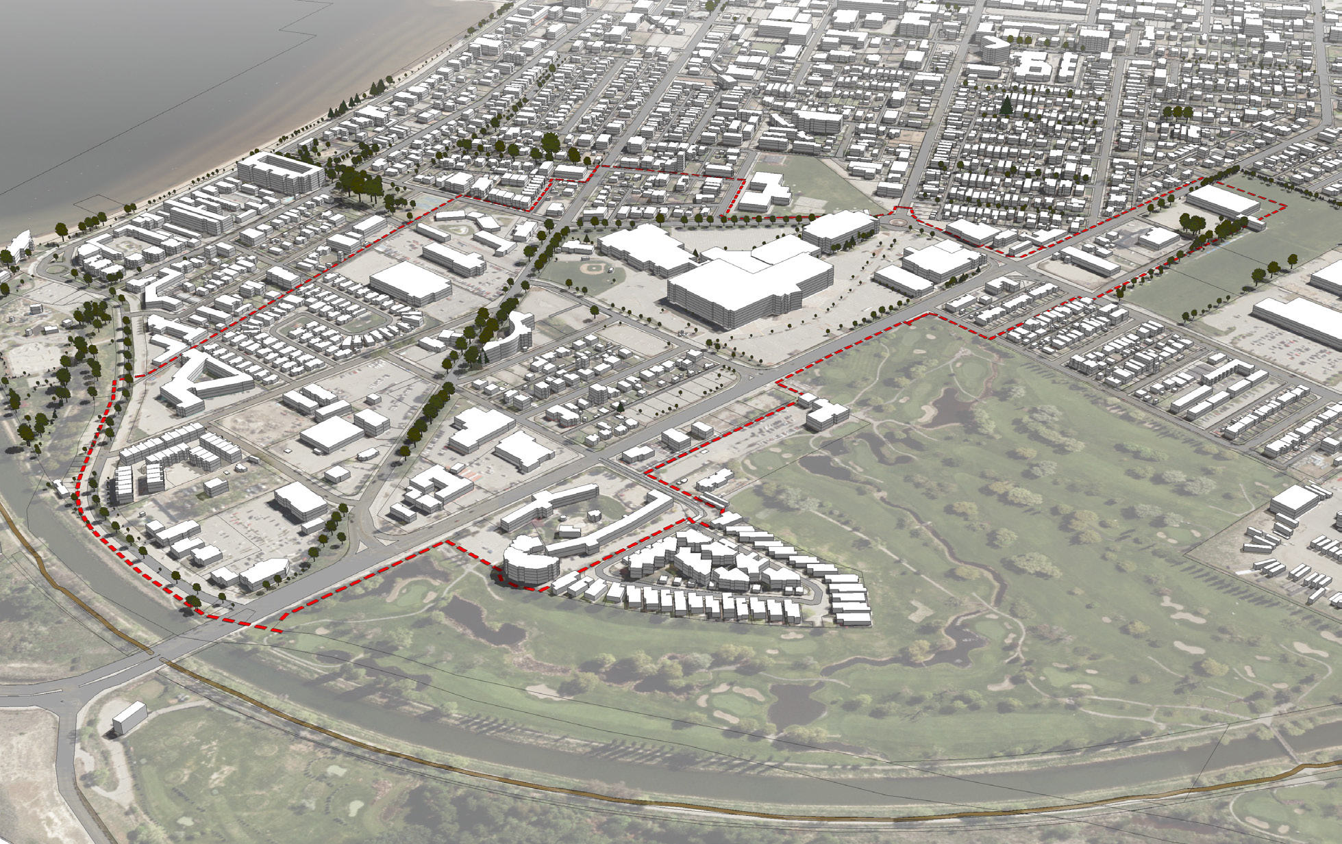
MVH Planning was completing a Downtown Master Plan in the City of Penticton, BC. In order to complete the work, the team needed a base plan for sketches. Normally resigned to using Google earth to estimate the existing urban form, Selkirk Planning & Design brought innovative techniques to provide a fully customizable, GIS integrated 3D model of the entire City.
Selkirk built a 3D model that included roads, trees, buildings, and natural features. The team then established contextual and detailed views that could be used to “illustrate” the plan as a whole. The model was built in one week using GIS data from the City of Penticton.